Planning a Caribbean vacation as the weather back home starts to cool, but aren’t quite sure about the best destination to visit? You’ll be happy to know that the Caribbean is a great place to be during the month of October!
With warm weather and fewer crowds than during the peak season of winter, the Caribbean is a perfect fall destination. Here are the best Caribbean islands to visit in October.
Barbuda
Located just north of Antigua is the gorgeous island of Barbuda, which is famous for its stunning coastline. Not too many people actually live here, but it’s an incredibly popular spot with tourists due to its tropical marine climate, which makes the temperature stay about the same all year.
While on your trip to Barbuda, a popular activity is to go to the Two Foot Bay National Park to see the caves. Pink Sand Beach is also a beautiful spot, and the Frigate Bird Sanctuary is an unmissable site for those who love wildlife.

Andros Island, Bahamas
Andros Island, located in The Bahamas, is one of the best Caribbean islands to visit in October for those who don’t want to travel too far from the U.S. since it’s located just a quick flight from Florida. Stretching to more than 100 miles long, this breathtaking island has much to discover, including a huge number of swamplands, mangroves, estuaries, and islets just begging to be explored.
From the underwater landscapes of the giant (the third-largest in the world) to the extensive array of biological diversity, there’s nowhere better in The Bahamas if you’re looking to explore nature.
One stop to put on your list is West Side National Park, which is one of the largest Marine Protected Areas in the Western Atlantic. October weather is warm on Andros Island, making it a perfect time to go snorkeling or scuba diving, or simply relax on one of the great beaches and soak up the sun!

Grand Cayman
Looking for a fun-filled tropical getaway? Why not visit The Cayman Islands? It is composed of three islands, with Grand Cayman being the largest (although still relatively small in comparison to some other destinations in the area). This is the one most choose to visit, usually in the sought-after destination of Seven Mile Beach.
Tourist-friendly and packed with fun things to see and do, Seven Mile Beach is not only a great destination in itself but is also conveniently located just north of the capital city of George Town. Here you can visit the port, the Cayman Crystal Caves, the Cayman Spirits Distillery (known for traditionally aging their spirits under the sea), and plenty of shops and restaurants.
One of the best dive sites in the Caribbean can be found here too: the USS Kittiwake, located just off of Seven Mile Beach. Grand Cayman has picture-perfect weather all year round and is a picturesque and romantic Caribbean island to visit in October. Be sure to keep an eye out for the stingrays and endangered blue iguanas while you’re there!
Jamaica
One of the most popular islands in the Caribbean, Jamaica is another top contender for the best Caribbean island to visit in October. If you’re seeking fun, sun, late-night bars, and plenty of outdoor adventure, this could be the perfect spot for you. You’ll find fewer crowds, excellent weather, and the historic natural parks at their very best.
A top destination is Montego Bay, where you can find great shopping and activities as well as plenty of places to stay. Don’t miss the famous Dunn’s River Falls and the Blue Lagoon, the latter of which is thought to be the result of the crater of an extinct volcano.
With beaches aplenty, breathtaking waterfalls, and a huge variety of activities, there’s always something to do. Jamaica is one of the best destinations for foodies too. Be sure to try some Jamaican classics such as jerk pork or chicken, ackee with saltfish, and patties.
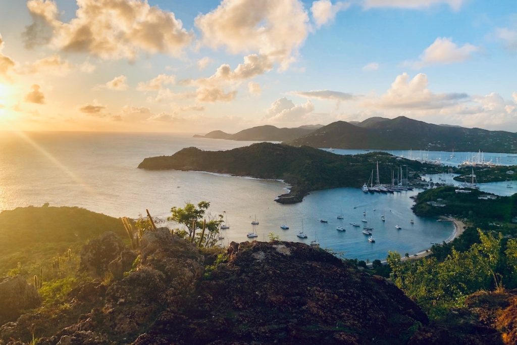
Antigua
Looking to extend your summer and have an action-packed outdoor getaway? Then Antigua could be the perfect place for you. Boasting warm weather and a variety of stunning beaches, Antigua is one of the nicest islands in the area, particularly during October.
While October is the middle of the low season in Antigua, don’t let this put you off. Temperatures still land in the 70s, making it a great time to enjoy being outdoors without getting hot. There are also fewer tourists and cheaper hotel rates.
Be sure to check out Galleon Beach, where you can find soft white sands and dazzling blue waters, or take a quick hike up Shirley Heights, from which you can see the best views Antigua has to offer. Hiking enthusiasts may also enjoy a bit of a longer hike, up to the summit of Mount Obama (yes, it’s named after the recent U.S. president!). The hike to the top can take around 3 to 4 hours and be quite muddy, especially if it has been raining, so pack appropriate footwear.
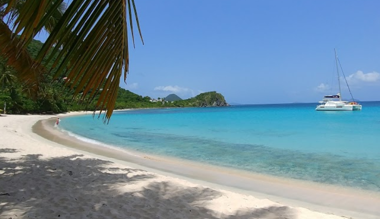
British Virgin Islands
The British Virgin Islands are a great destination for those who enjoy water-based activities such as sailing, swimming, snorkeling, and scuba diving. Situated just east of Puerto Rico, this group of islands and islets stays warm, with temperatures in the mid to high eighties at this time of year.
The island of Tortola is one of the most popular and is home to the largest town in the British Virgin Islands, Road Town. If you’re interested in island hopping and discovering new beaches, the British Virgin Islands is the place to be. Be sure to experience some of the most iconic sights and activities during your visit, such as swimming between the boulders at the Baths in Virgin Gorda.
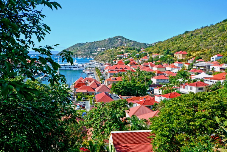
St. Barts
Another great island for beachlovers is St. Barts. It’s home to 22 public beaches across the island, with 15 boasting great waters for swimming and snorkeling. Be sure to stick to the eastern side of the island for calm waters and gentle waves.
With coral reefs offshore, you can also enjoy seeing a wide array of marine life, which is protected by the island’s nature reserve. Anse de Grande Saline is a nudist beach, so if you want to sunbathe in a clothing-optional environment, then this is the place to go.
This small island is located in the southeastern area of the Caribbean, and it is a luxurious spot, teeming with 5-star luxury accommodations and private yachts. If you’re planning on visiting this island, you may want to dress up for every meal!
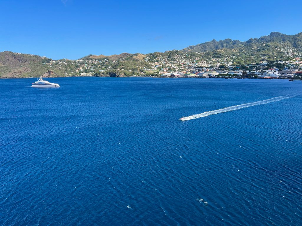
St. Vincent and the Grenadines
Situated in the southeastern region of the Caribbean, St. Vincent and the Grenadines is a collection of small islands located just southwest of Barbados. It is one of the best Caribbean islands to visit in October if you love nature and beautiful botanical gardens.
St. Vincent’s Botanic Garden is actually the oldest one in the Western Hemisphere, making it the perfect place to visit for an end-of-summer getaway. Known for its thick forests and amazing volcanoes, St. Vincent’s western side has steep rocky cliffs. The eastern side boasts gorgeous sandy beaches, popular with tourists. Mustique Beach and Saltwater Bay Beach are two of the most common, both featuring white sand and gentle waves.
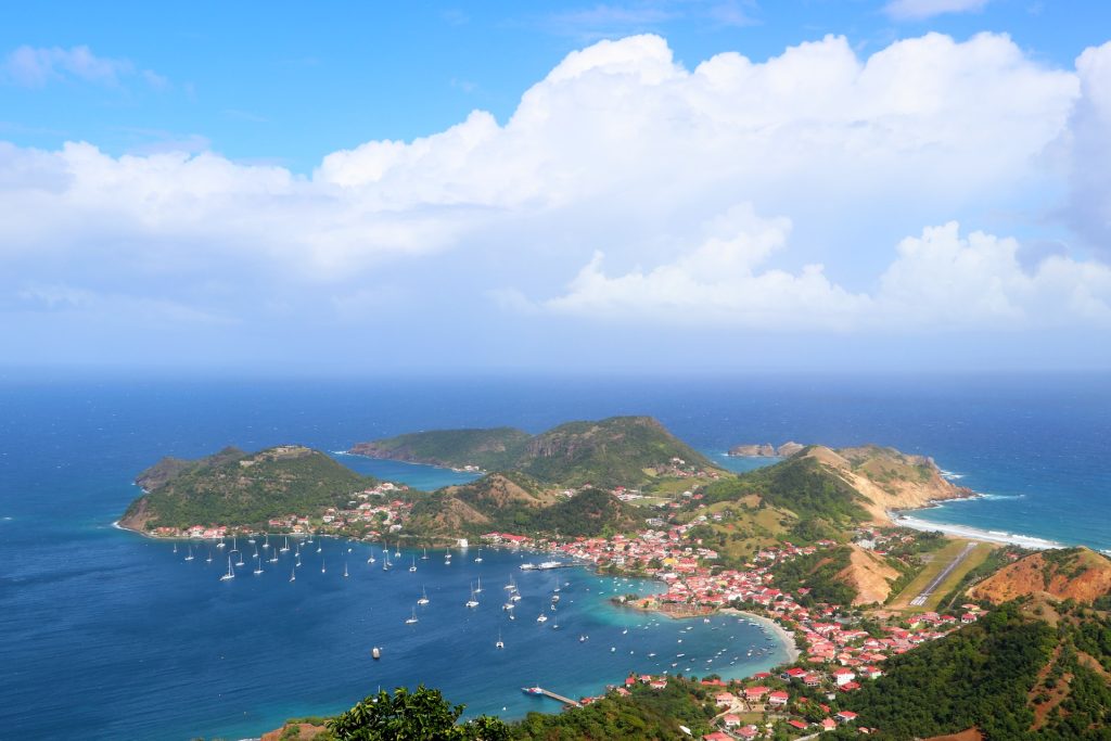
Guadeloupe
Another collection of islands, Guadeloupe is home to more than 12, with Grande-Terre being one of the best to visit. Temperatures here in October sit mostly in the high eighties, making it a lovely warm escape from the cool autumnal weather back home.
The area is home to a range of scenic hills, white sandy beaches, mangrove stands, and breathtaking coastal cliffs. There are great coral reefs offshore if you like to snorkel and scuba dive. At Guadeloupe National Park, you can find amazing sights such as La Soufriere Volcano and La Grande-Anse.
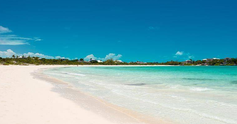
Turks and Caicos
Looking for a relaxing beachfront getaway? Look no further than beautiful Turks and Caicos. This dual-island nation is known for its incredible white sand beaches and natural attractions, including one of the world’s longest coral reefs and the world’s only conch farm.
One of the most popular spots is Grace Bay Beach, but there is a wide selection of other smaller and more secluded beaches to choose from if you’re looking for a tranquil, private paradise. Be sure to check out some favorites such as Bight Beach and Malcolm’s Road Beach, which don’t get as many visitors as Grace Bay.
You can enjoy a variety of watersports in Turks and Caicos, including sailing, kayaking, jet skiing, snorkeling, and scuba diving. You can also hop on a ferry and spend time at North Caicos and Middle Caicos to see more stunning landscapes and unbeatable views.
Now that you’ve read our list of the 10 best Caribbean islands to visit in October, which is your favorite? If you still can’t choose the perfect spot, feel free to reach out to one of our trusted travel advisors, who can help you plan your perfect fall Caribbean getaway.